Select Language:
Researchers have documented 335 non-earthquake landslides that caused damage to roads with rocks, mud, and ice between 1990 and 2023.
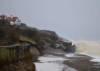
A minor shallow landslide occurred along the N45 near Balakot. PHOTO: NAZIR BAZAI
The unpredictable fluctuations in temperature and rainfall are prompting landslides in Pakistan, even along a heavily traveled and picturesque mountain route known as the ‘tourism highway.’
Pakistani and Chinese experts analyzed the N-15 highway, which passes through scenic regions including Balakot, Babusar Top, Naran, and Chilas. They examined 455 satellite images, climate data, and on-site human feedback spanning from 1990 to 2023, discovering at least 335 landslides, none of which were triggered by earthquakes. These events included rocks, mud, and ice crashing onto infrastructure and blocking the highway.
The researchers employed a three-step methodology: first, they collected satellite imagery from Landsat and Sentinel-2 satellites for remote observation; second, they downloaded Google Earth images to verify landslide occurrences and boundary delineations; third, they conducted ground surveys in areas identified by the satellite data.
Climate data indicates a rise in temperatures and precipitation during this period, correlating with an increase in landslides. The study also analyzed daily weather records—including soil moisture, heat, rainfall, snow cover, and vegetation—and concluded that landslides grew more frequent over time, notably after 2005, due to higher temperatures, snowmelt, and rainfall.
The data shows that about 84.1% of landslides happened during the warm months from April to October, emphasizing the need for enhanced monitoring and early warning systems in this timeframe.
Landslide behaviors vary according to the area’s geology. For instance, Balakot has subtropical conditions with high precipitation—mainly rain and ice—that often trigger landslides. The region from Babusar Top to Naran is alpine, where soil moisture and rainfall are primary factors. In contrast, Chilas, being semi-arid, experiences landslides mainly caused by geological features and heat.
This study offers valuable insights into three distinct mountainous climatic zones, which can guide future risk assessments, infrastructure development, early warning initiatives, and disaster mitigation strategies.
Monitoring stations established by Dr. Bazai’s team at the China-Pakistan Joint Research Center and KIU help track glacier avalanches and landslides. PHOTO: NAZIR AHMED BAZAI
Rising temperatures accelerate snow and ice melt, thawing frozen ground and increasing underground water pressure. Changes in rainfall patterns further intensify surface runoff and soil saturation, heightening landslide risks. Notably, these extreme weather shifts are more pronounced after 2005.
While geology, soil type, moisture, and vegetation all influence landslide susceptibility, steep slopes are especially vulnerable. Using 12.5-meter resolution ALOS PALSAR elevation data, researchers determined that over 86% of incidents occurred on slopes steeper than 40°, with 65% at elevations between 1,000 and 2,500 meters. These figures are crucial for developing early warning systems and planning risk reduction measures.
Field teams conducted two visits along the N-15 Highway in August 2022 and April 2023 to improve data accuracy. Local residents knowledgeable about geohazards provided insights on nearby landslides threatening communities.
Satellite imagery proved effective in identifying unstable regions; for example, in 2022, satellite data detected instability in Balakot, later confirmed by field surveys revealing displaced debris and damaged infrastructure. Nazir Ahmed Bazai of the China Pakistan Joint Research Center on Earth Sciences underscores the importance of integrating local knowledge and scientific observations. “In 2022, satellite data indicated instability in regions like Balakot, which we confirmed through fieldwork,” he said. “Community members share how they adapt by avoiding high-risk areas during monsoon season or relocating temporarily. However, limited resources and infrastructure mean responses are mostly reactive rather than proactive. Combining local insights with scientific data is key to enhancing early warning systems and building resilience over the long term.”
Bazai advocates for both natural and engineered solutions. He recommends using low-cost bioengineering techniques, such as planting deep-rooted vegetation to stabilize vulnerable slopes. He also suggests constructing protective barriers and improving drainage infrastructure along the highway to reduce landslide frequency and severity. Real-time monitoring with affordable sensors that track rainfall, soil moisture, and snowmelt—particularly near Babusar Pass—could deliver timely alerts for residents and visitors.
Community education campaigns on landslide evacuation procedures and the use of monitoring tools can bolster local preparedness, Bazai added.
In 2019, Dr. Melanie Froude of the University of Sheffield and Dave Petley, Vice Chancellor of the University of Hull, compiled the Global Fatal Landslide Database, which recorded 1,583 deaths caused by 215 non-earthquake landslides in Pakistan between 2004 and 2016. She emphasizes the importance of research, regulation, and education in preventing such tragedies.
In an interview with The Express Tribune, Froude explained that landslides are often viewed as local issues requiring a nuanced understanding of regional geology and environment. “Research helps us understand how hillslope materials respond to factors like rainfall or added weight, revealing when slopes may become unstable,” she said.
She urges strict regulation—such as inspection and enforcement of construction rules tailored for mountain environments. Proper planning concerning building size, foundations, and adherence to national standards are essential.
Education is equally critical. By understanding the causes of slope failure, communities and local authorities can better prepare and respond. “Engineers use sophisticated models to design stable slopes, but these are often costly. Providing simple, effective, low-cost guidance tailored to local geology and climate is vital, especially where technical expertise may not be affordable,” Froude noted. She also highlights the role of NGOs and community groups in raising awareness about landslide risks.
One practical approach involves maintaining vegetation on slopes and installing efficient drainage systems to reduce water accumulation.