Select Language:
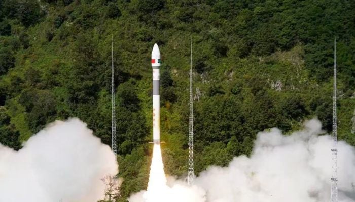
- Satellite launched from China’s Xichang facility.
- Fifth Pakistani satellite now active in orbit.
- Ahsan Iqbal praises Suparco and China’s support.
Karachi: Pakistan has successfully deployed its newest remote sensing satellite into space from China’s Xichang Satellite Launch Centre (XSLC), announced the Space and Upper Atmosphere Research Commission (Suparco) on Thursday. This achievement marks a significant step forward in the nation’s expanding space program.
According to a spokesperson from the national space agency, this new satellite will bolster capabilities in Earth observation, agricultural monitoring, and environmental analysis.
The launch was carried out in partnership with China Electronics Technology Group Corporation (CETC) and MICROSAT China.
This satellite will also support geospatial data collection and monitoring strategic projects such as the China-Pakistan Economic Corridor (CPEC). It will aid regional planning and natural resource management efforts.
Suparco’s spokesperson added that the satellite will assist in identifying transportation routes and natural hazards.
This marks Pakistan’s second remote sensing satellite since PRSS-1, which was launched in 2018. With the addition of the new satellite, the country now has five operational satellites, enhancing its capacity for space-based surveillance and disaster response.
The launch aligns with Pakistan’s broader National Space Policy and Vision 2047. Equipped with cutting-edge imaging technology, the satellite will help predict and reduce natural disasters, including floods, earthquakes, landslides, and glacier melting.
Suparco reports that the satellite features advanced imaging systems capable of continuous data collection to support precision agriculture, disaster management, urban development, and climate monitoring.
Planning Minister Ahsan Iqbal congratulated the nation on this success, praising the Suparco team, engineers, and scientists for their efforts. He confirmed that the satellite has reached its designated orbit and appreciated China’s robust support for the mission.
On X, Iqbal called the launch “another URAAN of Pakistan” and a moment of national pride. He highlighted that the achievement showcases the dedication and excellence of Suparco and its talented team, and he emphasized that it strengthens Pakistan-China friendship beyond space. He also announced that next year, with Chinese assistance, Pakistan will send an astronaut into space. The country also aims to reach the Moon by 2035.
The Foreign Ministry issued an official statement calling this launch a “major milestone in space exploration and technological progress,” reaffirming Pakistan’s commitment to innovation and sustainable development.
Previously, Suparco explained that the satellite would significantly improve resource management, support precision farming, and facilitate urban and regional planning.
Pakistan’s space endeavors have progressed over the past decade, beginning with the launch of PakSat-1R in 2011, then PakTES-1A and PRSS-1 in 2018. In 2024, the country launched PakSat-MM1, providing fast internet in remote regions. The country’s first student-designed lunar satellite, iCube Qamar, also made headlines with images of the Moon’s surface.
Most recently, in January 2025, Pakistan launched its first fully indigenous satellite, EO-1, developed entirely by local engineers and scientists. This optical satellite is designed for agricultural, disaster, and environmental monitoring.