Select Language:
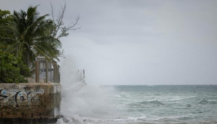
Waves swell as a Category 5 Hurricane Erin nears San Juan, Puerto Rico on August 16, 2025. —AFP
– Erin escalates from Category 1 directly to Category 5 in just over 24 hours.
– The storm’s center is approximately 135 miles northwest of Anguilla.
– It is battering Caribbean islands with rain and strong winds but not expected to make landfall.
Hurricane Erin intensifies swiftly offshore into a “catastrophic” Category 5 storm on Saturday, bringing heavy rain and wind to Caribbean islands. Weather officials have issued warnings for potential flash floods and mudslides.
The first hurricane of what is predicted to be a notably active Atlantic hurricane season, Erin is expected to drench islands with rain and gusty winds without actually hitting land.
According to the latest update from the US National Hurricane Center (NHC), maximum sustained winds have soared to 160 mph (255 km/h). The storm’s eye is situated roughly 135 miles (215 km) northwest of Anguilla in the northern Leeward Islands, which includes the US and British Virgin Islands.
A flash flood warning has been issued for Saint Thomas and Saint John in the US Virgin Islands as outer rain bands from Erin move across. Additionally, tropical storm watches are in effect for St. Martin, St. Barthelemy, Sint Maarten, and the Turks and Caicos Islands.
Earlier Saturday, the NHC declared, “Erin is now a catastrophic Category 5 hurricane,” indicating winds exceeding 157 mph and major danger. It reached this intensity just over a day after transforming from a Category 1 hurricane—a rapid intensification that scientists attribute to global warming.
Meteorologists forecast the storm will drift over the weekend just north of the northern Leeward Islands, Virgin Islands, and Puerto Rico. It is expected to pass east of the Turks and Caicos Islands and southeastern Bahamas late Sunday before gradually weakening.
Isolated areas might experience up to six inches (15 centimeters) of rain, posing flood risks. The NHC warned of possible flash flooding, urban flooding, and landslides.
Swells from Erin will impact parts of the northern Leeward Islands, Virgin Islands, Puerto Rico, Hispaniola, and the Turks and Caicos through the weekend. These waves will reach the Bahamas, Bermuda, and U.S. East Coast early next week, creating life-threatening surf and rip currents.
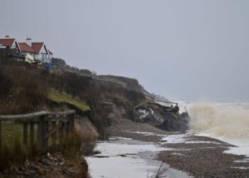
The hurricane is forecast to shift northwest Saturday night and then turn north early next week, weakening from Monday onward. While experts are confident Erin will stay offshore, dangerous waves and erosion could affect areas like North Carolina.
The Atlantic hurricane season, running from June through late November, is predicted to be more intense than usual. Last year brought several powerful storms, including Hurricane Helene, which caused over 200 fatalities in the southeastern United States.
The NOAA, which manages the NHC, has faced budget cuts and staffing reductions due to government austerity measures. Scientists note that climate change—specifically, rising sea temperatures from fossil fuel combustion—increases the likelihood of more severe and rapidly intensifying storms.