Select Language:
How Google Maps Interprets Country Borders in 2025: What You Need to Know
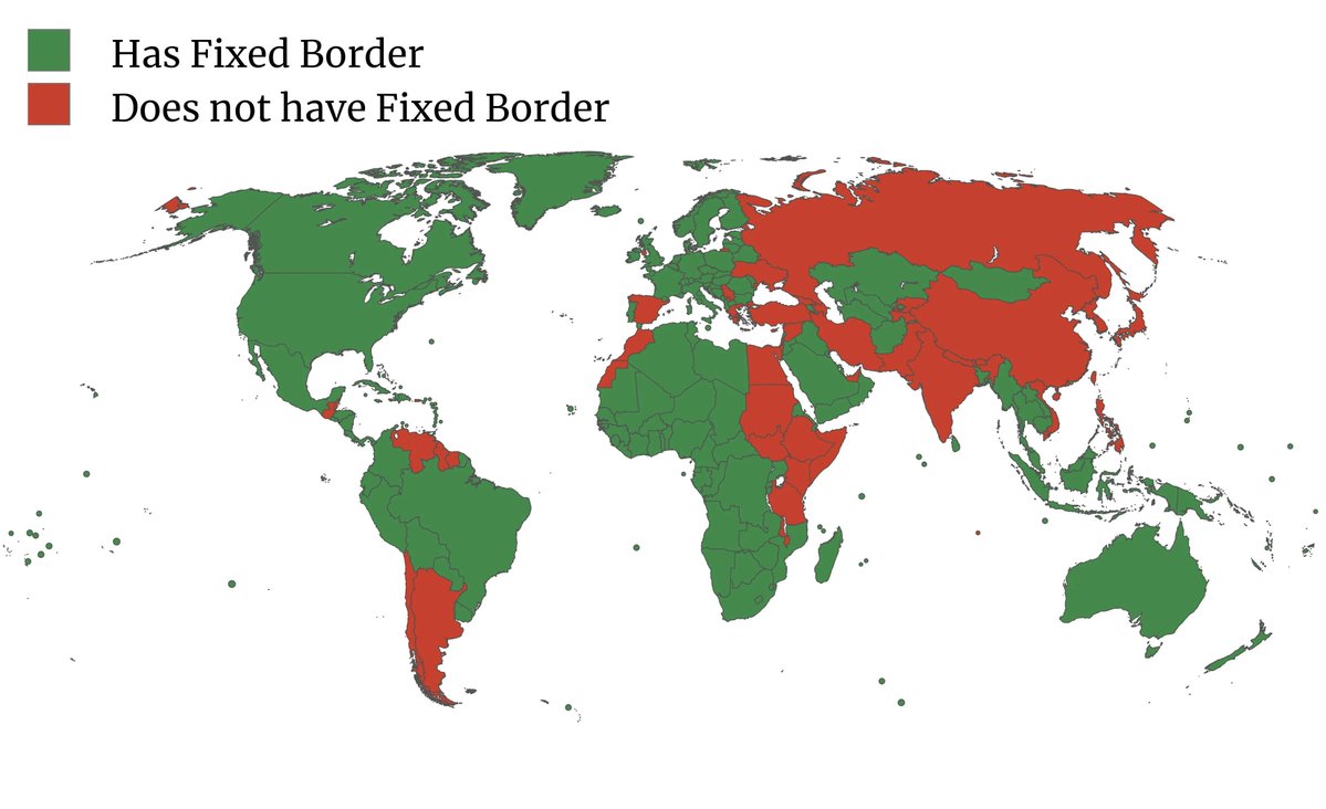
1. Clarifying the Concept of “Fixed Borders” in Google Maps
In 2025, Google Maps continues to be a crucial tool for navigation and geographical referencing worldwide. But many users are now questioning: does Google Maps recognize some country borders as fixed, unchangeable lines? Officially, Google Maps displays borders based on current international agreements, recognized territories, and documented disputes. However, this doesn’t imply that the borders are immutable in the digital map; rather, they reflect the official and widely accepted delineations at the time of data collection.
2. How Google Maps Handles Disputed Territories
Several regions in the world have ongoing territorial disputes—such as Kashmir, Israel and Palestinian territories, or Taiwan. In 2025, Google Maps often portrays these areas differently depending on the user’s location and the local legal context. For instance, in India, Google Maps displays Kashmir as part of India, aligning with official Indian government stance. Conversely, in Pakistan, the map shows Kashmir as a disputed region. This dynamic display raises questions about whether the borders are “fixed” or adaptable based on user context and geopolitical sensitivities.
3. The Influence of International Recognition and Local Policy
Google Maps’ approach to borders varies by country and policy. It strives to balance international standards with local laws. In some cases, Google adjusts map borders to comply with national regulations to avoid legal complications—like displaying Taiwan as separate from China in certain regions, or aligning with the official stance of the country viewing the map. This means that, in some instances, borders on Google Maps are not necessarily “fixed” but are instead influenced by diplomatic and legal considerations.
4. Updates and User Input: Borders Are Not Static
In 2025, Google Maps frequently updates its data through automated processes and user contributions. When border disputes get resolved or new treaties are signed, Google’s team updates the maps accordingly, sometimes swiftly. Unlike physical borders, the digital borders represented in Google Maps are reconfigurable and subject to change, making it inaccurate to think of them as “fixed” in a literal sense. Instead, they are flexible representations of current international consensus or policy.
5. Why Some Borders Appear Fixed and Others Don’t
Certain borders, like those between established sovereign nations, tend to appear more stable on Google Maps. But even then, maps may not always be entirely consistent, especially in regions with ongoing disputes or shifting political landscapes. In 2025, the perception of “fixed borders” often depends on the geopolitical context, local laws, and Google’s policy choices. So, it’s essential to understand that digital borders are fluid representations that can change based on new developments.
6. Impact of Sovereignty Claims and Cartographic Disputes
Many countries maintain sovereignty claims over specific territories, which Google Maps reflects variably depending on the viewer’s location. These disputes can lead to visual inconsistencies—such as different border lines seen from different parts of the world. In some cases, Google Maps may soften borders or highlight areas as “disputed,” emphasizing the ongoing debate rather than asserting fixed boundaries.
7. How Google Maps Balances Accuracy and Diplomacy
As the digital map of the world, Google strives to provide the most accurate, up-to-date information while respecting international and national policies. This balancing act often results in different border representations in different regions. In 2025, that means recognizing that borders are complex and sometimes ambiguous, rather than fixed, definitive lines cast in stone.
8. Future Trends: Will Borders Become More Fixed in Digital Maps?
Looking ahead, Google Maps and similar platforms are expected to adopt more sophisticated systems for representing borders—possibly integrating legal, cultural, and historical data to provide more nuanced maps. However, the core challenge remains: borders are inherently political and subject to change. As a result, digital maps like Google’s are likely to evolve into dynamic, multi-layered tools that reflect shifting realities rather than fixed borders.
Summary:
In 2025, Google Maps does not treat borders as fixed in stone; rather, they are flexible, context-dependent representations influenced by international standards, local laws, and ongoing disputes. While some borders appear stable, many are subject to change as geopolitical climates shift and new agreements are reached. Users should remain aware of this fluidity, especially when interpreting territorial boundaries on digital maps in a complex global landscape.